Patch Notes
v1.17.1 - Sign in with Google
Jul 9, 2026You can now sign in with Google, no password to set or remember. The rest of this release is a round of fixes and small improvements gathered since 1.17.
A Continue with Google button now sits on both sign-in forms, the home sign-in modal and the profile panel. One tap and you are in, using your existing Google account. Email and password still work exactly as before if you prefer them.

Keep an eye out for the new topographic contour mark, now across the app, favicon, and browser tab.
The hole depth cap now follows the model's own height, so a hole can reach clean through thin terrain when you want it to. You can also place a single centered hole, and set a radius or count that the schematic previously would not accept.
Border width can now be set to zero for a borderless coaster. Flat coaster caps no longer pick up baked shadows or a detail drop when you orbit, so the top surface stays clean.
Added a Reset Grid button that clears the tile selection and returns the grid to its defaults. Square and rectangle grid tiles no longer render see-through or overlap at their edges.
A brand new project with no models now opens straight onto the map with a get-started note, instead of the blue add-models-to-preview screen.
v1.17 - Edge Taper
Jul 8, 2026Draw a guide on the map and the terrain tapers down to the base along it. Good for clean edges, framed pieces, and killing the spiky rim you sometimes get on a cut.
A new tool for tapering terrain down to the base along edges you draw. Open the Edge Taper card, draw a guide on the map, and the terrain on the low side slopes down to the base across a band you control. Use it to clean up an edge, blend a model into a frame, or flatten a rim that printed too sharp.
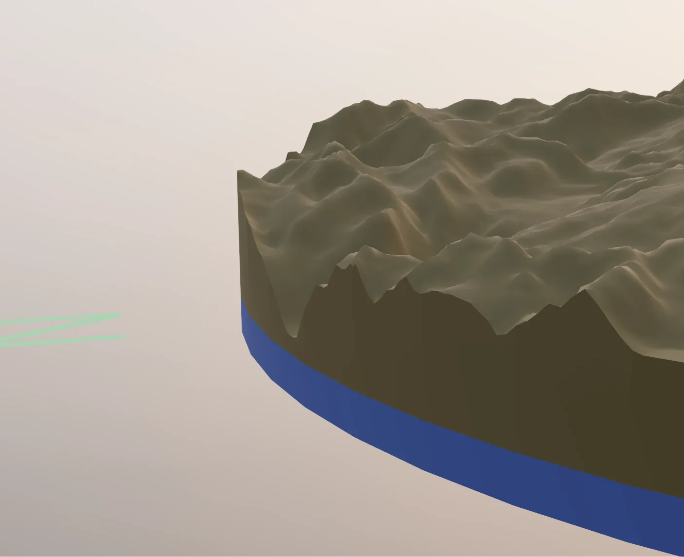
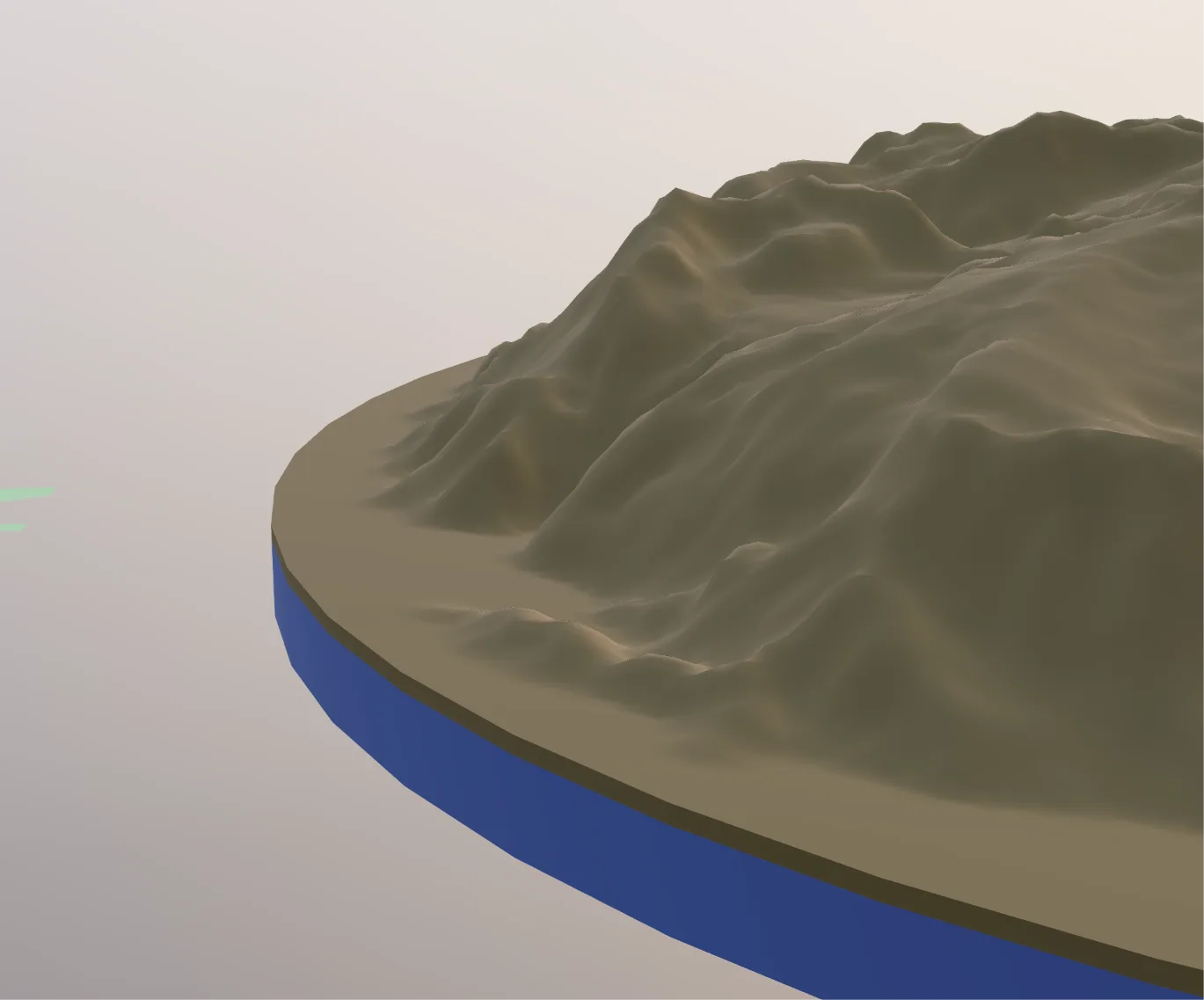
- Detect edges: Let the tool read your model's own boundary and offer each edge as a guide, hover to highlight, click to add. No tracing by hand.
- Or draw your own: Add a spline or polygon guide instead, then pick which side drops to the base.
- Profile curve: A small graph controls how the elevation falls off across the band, from the outer edge to the guide. Drag points to shape it, and set the band width in millimeters.
- As many guides as you need: Taper one edge or all of them.
With grids, a project can end up with a huge number of tiles, and setting up magnet holes on each one by hand is a real pain. A better workflow for this is in the works, but as a quick fix you can now copy a magnet hole set and paste it onto another tile, so every grid tile gets the exact same magnet placement without rebuilding the layout each time. Use Copy code on a hole set, then Paste on the tile you want it on.
A big upgrade to how shorelines come out. We no longer calculate the coastline from elevation data, we now pull the real coast straight from our map service. The result is cleaner, truer shorelines that follow the actual coast, without the jagged edges and stray islands the old calculated approach could leave behind.
Terrain now keeps a small minimum thickness (0.4mm) everywhere, applied in both the preview and the export geometry. This stops near-flat or below-datum spots from thinning out to nothing or leaving voids in the print.
v1.16.2 - Printed in Grid
Jul 7, 2026A quick look at a multi-tile grid project coming off the printer and assembling into one continuous piece.
A short clip of a grid project printed as separate tiles and put together into a single seamless model. This is the multi-model grid workflow from 1.16 in the real world.
v1.16.1 - Shape Outline Fixes
Jun 14, 2026Hexagon shapes now render consistently across the 2D map preview, the 3D model, and grids. Projects saved before this update keep their original hexagon orientation.
Standalone pointy-top and flat-top hexagons now match between the 2D map preview and the printed 3D model. Projects saved before this update keep their original flat-top hexagon.
v1.16 - Multi-Model Projects
Jun 12, 2026The biggest structural change since the Workspace update: one project now holds many models, all sharing scale and elevation. Build a grid, drop models onto the map, and export the whole set as a single coordinated layout.
A short look at what's new in this update: multiple models in one project, grids, and coordinated export.
A full walkthrough of the new multi-model workflow, building a grid, placing models, and exporting a coordinated set, is on the way. For now, the short overview above covers the essentials.
A project is no longer a single model. One project now holds as many models as you want, all sharing the same scale and elevation reference. Each model still keeps its own bounds, shape, painted features, and holes. Switch between them, edit one at a time, and export them together as a coordinated set.
- Shared coordination: Models in a project print at consistent size and height because they share one scale and one elevation datum.
- Per-model independence: Each model keeps its own boundary shape, feature painting, and utility holes.
- Settings moved to Global: Project-wide parameters (scale, elevation reference, elevation coloring, base) now live in Global Settings instead of being set on each model. Set them once and every model stays in sync, instead of juggling the same values on each model separately.
See every model in a project assembled into one 3D scene at true relative scale and geographic position, with feature layers and holes, before you export. Detail scales down automatically for projects with many models so the preview stays responsive.
Lay down a grid, position it over the map, and pick which cells become real models. Choose the cell shape (square, rectangle, hexagon, custom) and size, then select cells to capture them as models. Adjacent models are built to line up edge-to-edge, so a grid becomes a single seamless print spread across multiple parts.
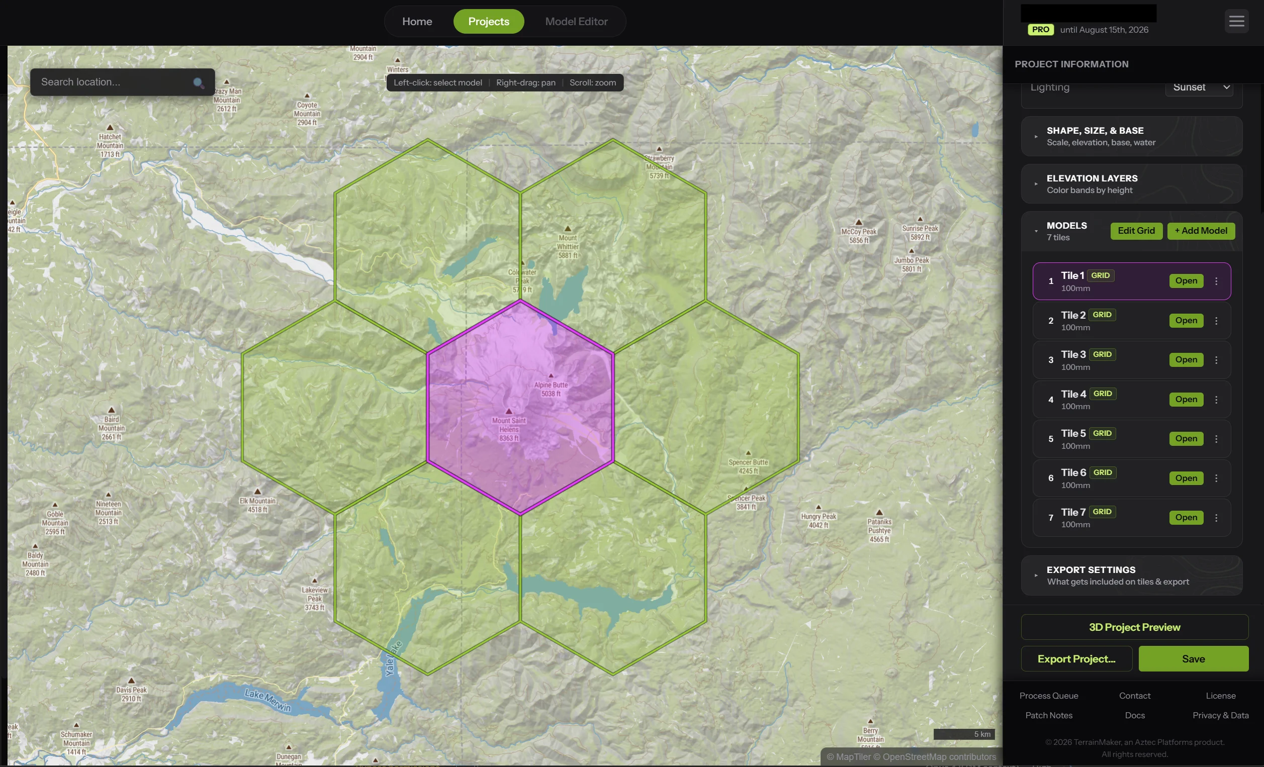
- Lock grid to land: Pin the grid in place so panning moves the map underneath it.
- Re-capture moved models: Reframe the grid over new terrain and the moved models re-capture in place, keeping their names and customizations.
Export a single model, or export the entire project at once. Project export lets you pick which models to include, choose quality, and either download each file as it finishes or bundle everything into one zip. Progress and a cancel option live in the process queue.
Supporting multiple coordinated models meant rebuilding the core geometry pipeline for correctness over raw speed. The 3D preview now runs the exact same path as the final export, so what you see is what you print. The tradeoff is more computation per model, which means large grids and the 3D project preview can feel slower than a single-model project did. This is deliberate. If you hit performance you consider unacceptable, please send me a note.
Getting adjacent models to meet flush, with no gap, no overlap, and matching terrain across the shared edge, was one of the hardest parts of this release. It took significant rework across the sampling, geometry, and cut systems to make models align precisely both on screen and in the final print. The payoff is a multi-model set that glues together cleanly into one continuous piece.
Every shape (presets, custom outlines, uploaded SVGs) now resolves from one authoritative outline, used identically by the map, the 3D preview, the print mesh, the reference SVG, and CAD export. This eliminates a class of bugs where a hexagon looked one way on the map but exported another, or a shape resized unexpectedly between views.
The preview and export now share a single shape-cutting core. Previously the preview used a faster approximation and the export used the precise method, which let them disagree. They are now identical, so the preview is an accurate proof of the printed part.
v1.15 - Custom Base Shapes & Islands
Mar 30, 2026No longer restricted to 5 basic shapes, now you can draw the exact shape of the terrain model! Includes a special feature to perfectly detect island edges.
No longer are you restricted to 5 basic shapes! You can now draw completely freeform boundaries directly on the map, or upload your own custom SVGs to perfectly define your model's outer edge. This unparalleled creative control flows perfectly into all other parts of the application, including the Feature Painter and Utility Options.
- Custom SVG Uploads: Bring your own designs! Upload any custom SVG to instantly use it as the precise outer boundary of your terrain model, allowing for infinite creative possibilities, unique frames, and perfect integration with your existing CAD workflows.
- Island Detection: We've included a special feature to perfectly detect the edges of islands so you don't have to place 300+ nodes just to capture a complex outline.
- Multi-Shape & Multi-Polygon Support: Shape outlines now support multi-shape and multi-polygon geometry. This gives us a really strong foundation to build on this and add other features as development continues!
- Coaster Mode Compatible: Custom shapes are fully available to use in Coaster mode so you can create completely flat designs in whatever shape you desire.
This massive update required adjustments to a lot of the systems that are already in place, so expect a little bit of bugginess as we iron out these features. If you have any issues with anything, please do let me know so I can get it fixed.
- Please Report Bugs! As we iron out these features, you might encounter a few quirks. If you have any issues with anything, please do let us know so we can get it fixed immediately.
- Performance Engine Boost: Moved massive chunks of the 3D geometry and custom shape pipeline onto background threads so the app remains perfectly responsive.
- Sleeker Toast Alerts: Rebuilt the app's notification system to be cleaner, faster, and much more informative.
v1.14 - Full Access Update
Mar 2, 2026Full access to TerrainMaker's tools for free - only pay when you export. Plus, major consistency improvements to Drawing Mode.
We've removed the barriers to entry. You can now use all of TerrainMaker's features, including the powerful Drawing Mode, entirely for free. Creating an account and paying is only required when you are ready to export your final model.
We've focused on giving you a consistent experience across all drawing tools whether you're creating new custom features or editing existing map features. Control nodes, splines, and polygons now share the same smooth, predictable workflow regardless of how the feature was added to your workspace. We've also resolved various edge cases and glitches in the Drawing Mode for a more reliable, precise editing experience.
v1.13 - The Drawing Update
Feb 26, 2026A major overhaul of the feature system, introducing a powerful new Drawing Mode.
Draw Mode brings two major enhancements:
- Create Custom Features: Create your own custom features from scratch using polygons, splines, and freehand drawing.
- Modify Existing Features: Edit existing features that you import from data sources. For example, if map data doesn't perfectly match elevation data, causing a river to render halfway up a cliff, you can now drag its control nodes right back down to the valley floor where it belongs.
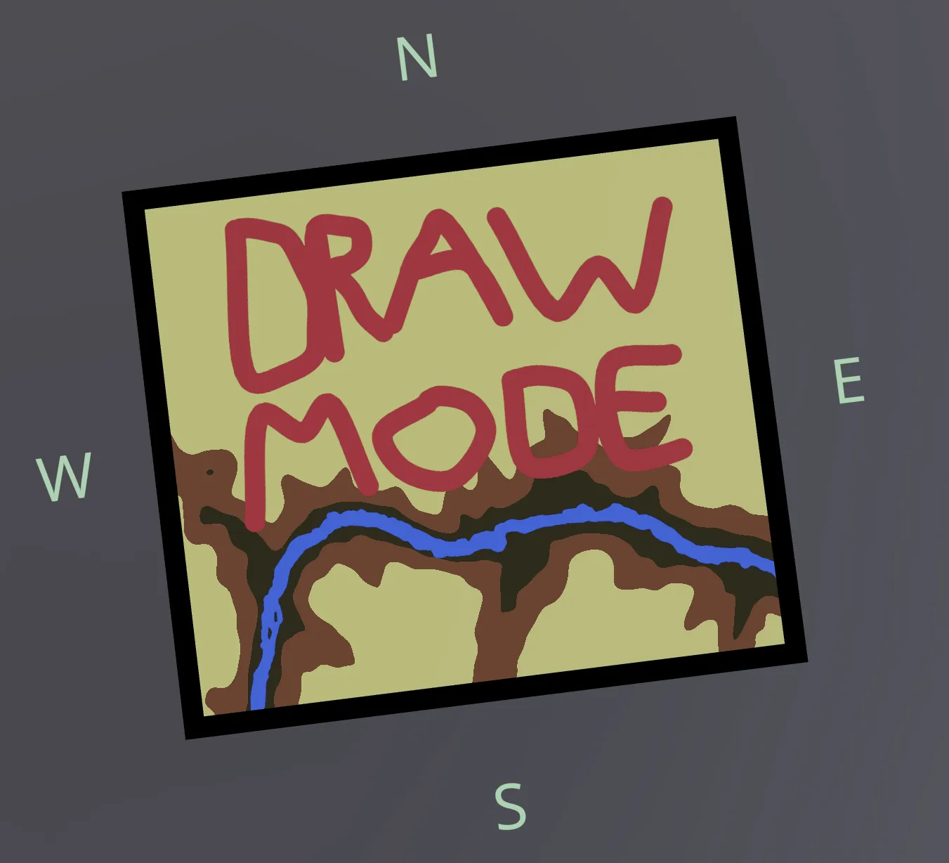
- Edit everything: Move, add, or remove control points on any lake, river, or trail instance.
- Draw your own: Create custom splines and polygons directly on the map to add features that don't exist in the source data.
- Reset to Initial State: Hit reset on any modified feature to instantly restore its original real-world shape.
- Stronger Foundation: A major rewrite of the OSM data import pipeline provides a more robust foundation for future terrain and coaster customizations.
- Interactive Composite Editing: Independently edit the centerline and polygon boundary of composite river features.
Security and convenience updates for your account management.
- Forgot Password: Request a password reset link directly from the login page.
- Password Reset: Securely update your password with the new self-serve reset flow.
General polish for a smoother editing and export experience.
- Clean UI Controls: Sliders and inputs now round to sensible precision, eliminating excessive decimal places.
- SVG Export: Download the placement guide SVG as a separate file for easier reference.
v1.12 - Coaster Mode
Feb 20, 2026Introducing Coaster Mode, a new project type that turns any terrain into a flat, printable coaster with elevation coloring, a customizable border ring, and full feature painting support.
A brand new project type. When capturing terrain, you now choose between Create Terrain Project (the classic 3D model) or Create Coaster Project. Coasters flatten the terrain into a solid disc while preserving elevation colors. Perfect for drink coasters, wall art, or display pieces.
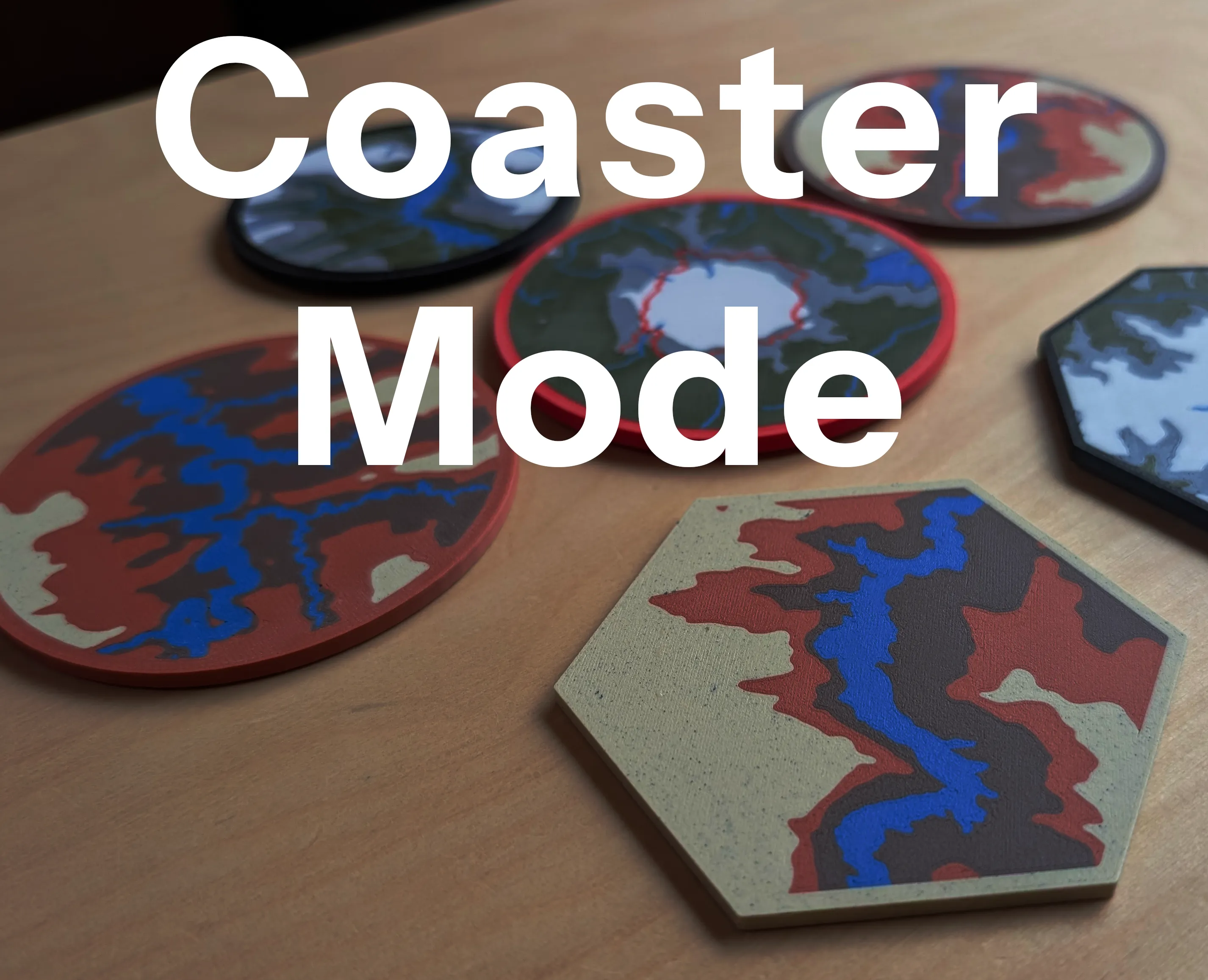
- Elevation coloring on a flat surface: The original terrain heights are mapped onto the flat coaster surface as colors, so you still see the mountain ridges, valleys, and coastlines.
- Customizable border ring: Add a border with adjustable width and color. The border exports as a separate mesh part for multi-material printing.
- Adjustable top depth: Control how thick the colored slab is (0.2–5mm).
- Feature painting works: Water, trails, roads, ski runs, and glaciers paint onto coasters just like terrain projects.
- All shapes supported: Circle, square, rectangle, hexagon, and octagon coasters.
- Duplicate existing projects: You can duplicate your existing terrain projects and convert them into coaster projects (and vice versa) without recapturing terrain data.
You can now add up to 3 independent hole sets per model, each with its own dimensions and placement pattern. Previously limited to a single set of holes.
- Color-coded sets: Each hole set gets a distinct color (amber, violet, sky) in the schematic editor and the exported SVG guide.
- Ghost preview: When editing one set, the other sets appear as faded outlines so you can avoid overlaps.
- Tighter default tolerances: Defaults tightened from +0.25mm/+0.2mm to +0.1mm/+0.1mm for more precise fits.
Map search now uses OpenStreetMap (Nominatim) for natural features like mountains, lakes, and rivers, ranked by real-world prominence. Famous landmarks surface first. Abbreviations like "mt" and "lk" are handled natively. Results appear as clickable pills so you can pick the right match.
When modifying your project boundaries, painted features (water, trails, etc.) are now visible on the map. A toggle lets you show or hide them for context while repositioning, making it easy to get the perfect bounds for your existing painted features.
Fixed layer height issues for water features and other veneers in the slicer. Vernier (color) layers now receive proper Z offsets to eliminate Z-fighting artifacts in slicer previews.
Elevation data now correctly recalculates when you modify project boundaries, preventing stale height values from carrying over.
v1.11 - Utility Options
Feb 12, 2026We've added utility options that let you add recessed holes to the bottom of your model, perfect for magnets, cork pads, or custom mounting solutions.
Add recessed holes to the bottom of your model for magnets, cork pads, or custom mounting. The Utility Options editor gives you full control over placement and sizing.
- Interactive schematic: A 2D bottom-view editor with live hole previews. Drag holes, rotate patterns, and zoom to fine-tune.
- Two placement modes: Circular Pattern for evenly spaced holes, or Grid mode for manual click-to-place control.
- Custom dimensions & tolerances: Set diameter, depth, and fit tolerances so holes print at exactly the right size.
- Smart base sizing: If your base is too thin, the editor warns you and offers one-click auto-sizing.
- Placement guide in every export: A
hole_placement.svgis bundled in the .3mf. Unzip the .3mf file to access it. - Watertight output: Holes are boolean-subtracted at export time, so your model stays manifold and slicer-ready.
v1.10 - Boundary Capture & Edit
Feb 10, 2026Overhauled terrain selection with interactive boundary drawing, edge handles, and shape previews. You can now modify project boundaries after creation without starting over.
New dedicated selection map for terrain capture with edge handles, repositioning, and a live shape overlay so you can see exactly what area is being captured.
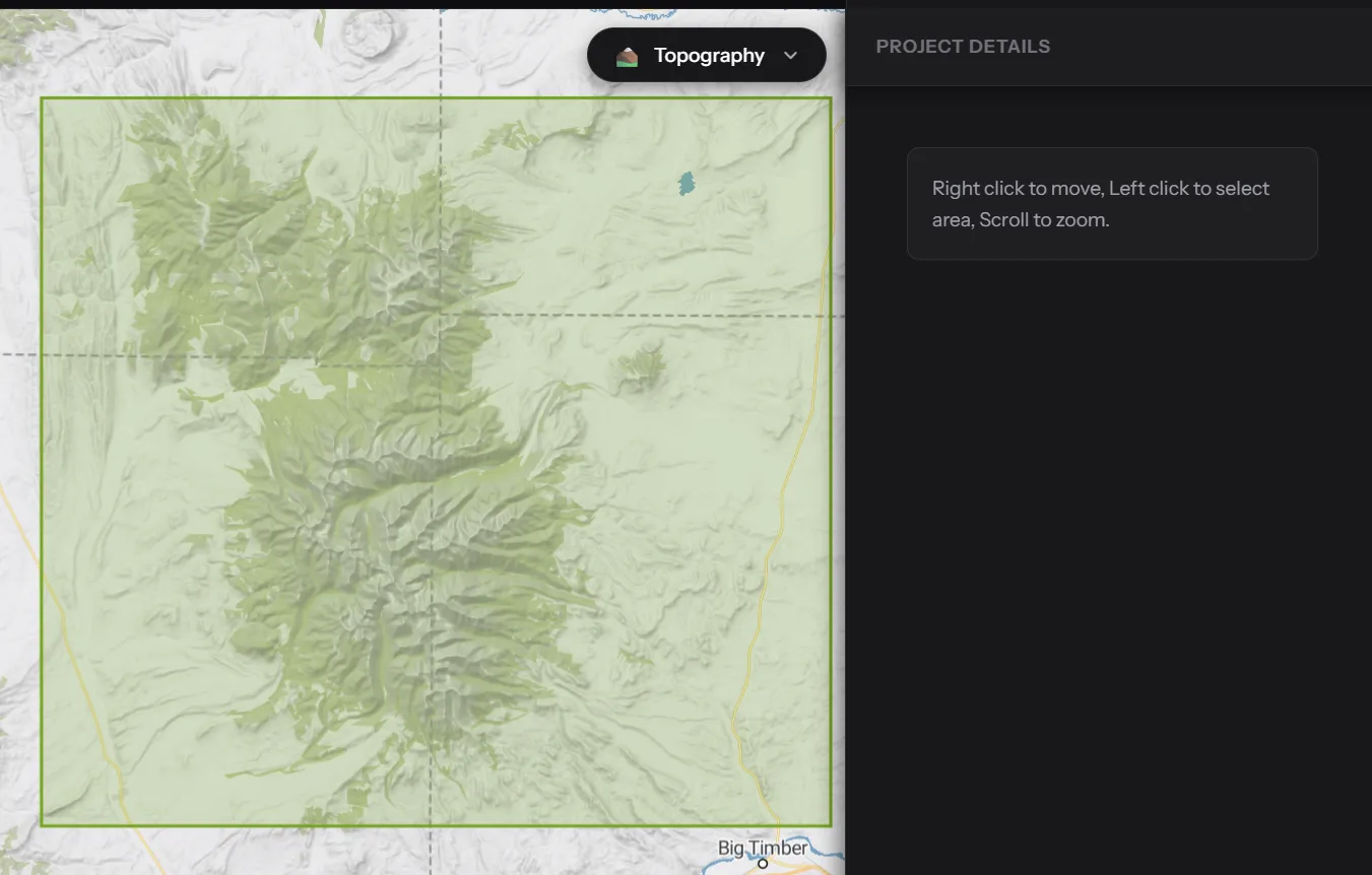
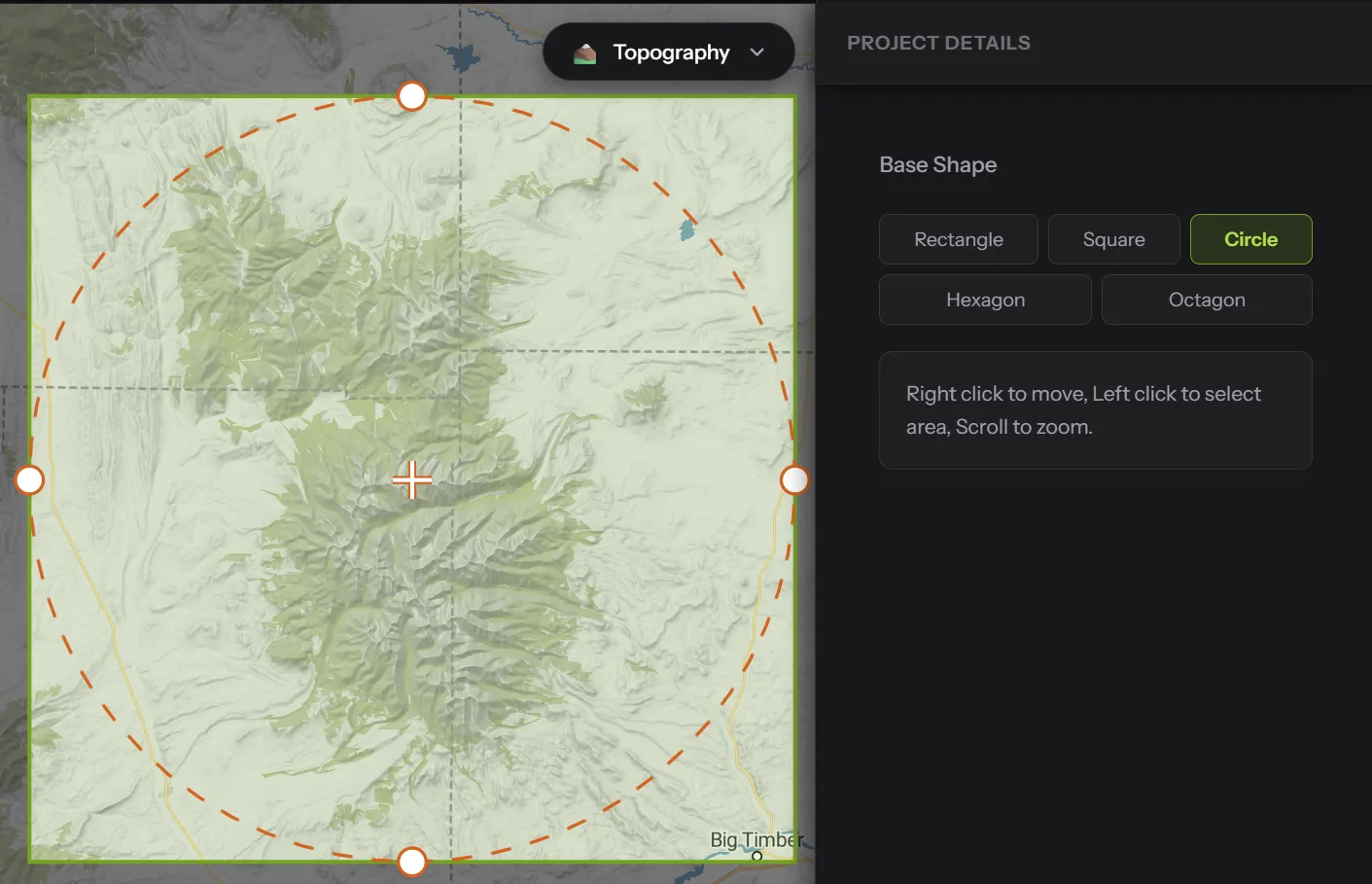
You can now adjust a project's boundaries after creation. Open Model Settings, click Modify Boundary, nudge any edge or reposition the selection, and re-capture. No more starting your project over because a ridge got clipped.
Combined search functionality using OSM data + MapTiler. This makes searching for natural features way better, because who cares about man-made stuff ;). New style switcher for Topography, Satellite, Outdoor, and Streets views.
v1.09 - Dual-Source Integration
Feb 7, 2026Reintegrated OpenStreetMap (OSM) to establish a dual data source model. This update restores glaciers with improved algorithms and prepares the system for future data sources.
When scanning for features, you can now choose between native tile data or OpenStreetMap (OSM) data, one of the most comprehensive and robust datasets for map features worldwide.
We've added robust support for polygons and reworked the structure to allow rivers to be rendered with precise polygon riverbanks. This enables much more detailed and intricate bodies of water, especially when working with smaller terrain areas.
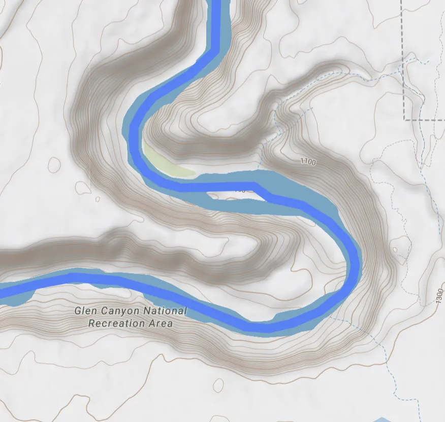
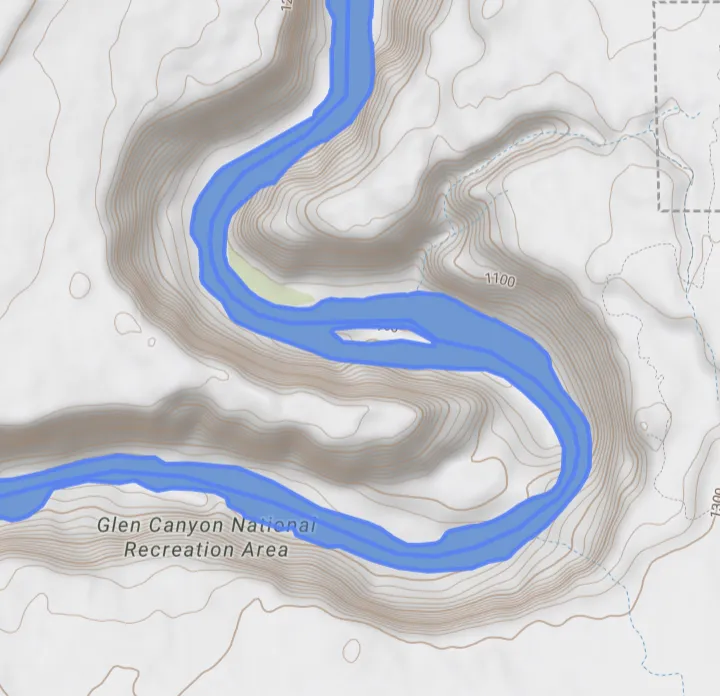
Glaciers are now supported via the OSM integration. New algorithms improve the searching, sizing, and grouping of glacial features for better accuracy.
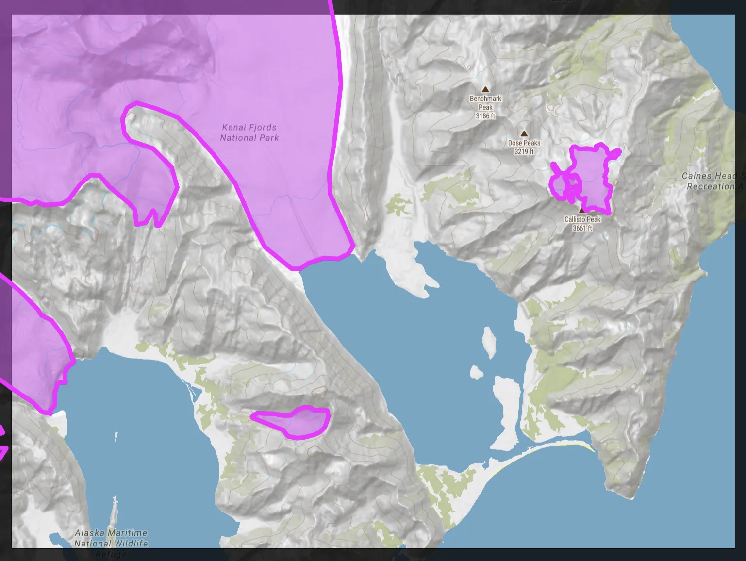
Control scan granularity by adjusting grid divisions. This enables fine-tuning detail levels for specific regions. Note: This feature applies only to MapTiler data.
v1.08 - The Workspace & Custom Routes
Feb 3, 2026A monumental shift from a linear workflow to a persistent, editor-style artscape.
You can now import your own GPX files to overlay custom routes onto your terrain. Whether it's a personal hiking trail, a bike path you've recorded, or any GPS track, simply load the file and use the Feature Painter to add it as a paintable layer on your model.
We are introducing a monumental shift in TerrainMaker. Since the last main branch, our focus has moved from a linear, one-time workflow to a persistent, editor-style artscape.
Previously, the creation process was a one-time event: generate a model, export, and done. Now, you have a true workspace. You can save your projects, return to them, and refine your work over time. If a physical print doesn't come out exactly right, simply reload the saved project, adjust the features or terrain settings, and export again.
This transition also brings a new grounded navigation flow, keeping you focused deeply in your work. Under the hood, this required massive refactoring of our core state management to handle complex project data reliably.
TerrainMaker is no longer just a generator; it is a tool for crafting and perfecting beautiful models of your memories.
Projects are now saved as complex state objects. You can reload your exact workspace configuration, including map selection, painted features, and camera angle. Pick up exactly where you left off.
We've implemented a strict "onion layer" navigation flow. You now return to your Editor Homepage foundation before switching contexts, preventing that "lost in menus" feeling and keeping you grounded.
The simple export button has been upgraded to a robust Process Queue. It manages background tasks for terrain generation and file exporting, letting you continue to work while the heavy lifting happens in the background.
Stop hunting for tiny segments. The scanner now automatically merges connected roads and rivers into single, selectable objects. Use the new Targeted Area Scan to drag a box over any region and find specific details instantly.
A new visual file explorer for your maps acts as your portfolio manager, allowing you to easily browse, rename, and reopen your terrain models.
v1.07 - Global Scale Update
Jan 28, 2026A massive architectural update migrating to a new map provider for seamless global data, introducing large-scale map stitching, and an adaptive feature scanner.
We've completed a full migration to a new back-end map provider, eliminating the requirement for a personal OpenTopography API key. Simply select your area and start creating.
You can now capture massive geographic areas. Our engine automatically grids, downloads, and stitches terrain tiles into a single coherent model, including full support for regions crossing the 180° meridian.
No longer will you see thousands and thousands of results in the feature scanner to sift through. We've overhauled the feature scanner to intelligently group road segments and prioritize major networks for large areas. Plus, our new 'Targeted Area Scanner' lets you drag a box on the map to find specific missing details in a focused region.
The Export Queue has been upgraded to a 'Process Queue.' It now handles multi-stage terrain captures and complex exports more reliably in the background, with real-time progress for every stage.
Fixed several alignment issues with mesh boundaries and improved the logic for grouping and consolidating road networks across large areas.
v1.06 - Feature Painting Update
Jan 25, 2026A massive architectural update introducing real-world feature painting, a high-performance shader-based 3D viewer, and a completely reworked export system.
You can now paint real-world features directly onto your terrain! Automatically scan for and highlight:
- Waterways: Lakes, rivers, and streams
- Ski Runs: Downhill and cross-country pistes
- Pathways: Hiking trails, cycling paths, and roads
- Glaciers: Permanent ice and snowfields
These features are exported as separate physical meshes in the .3mf, allowing for precise multi-material 3D printing of maps.
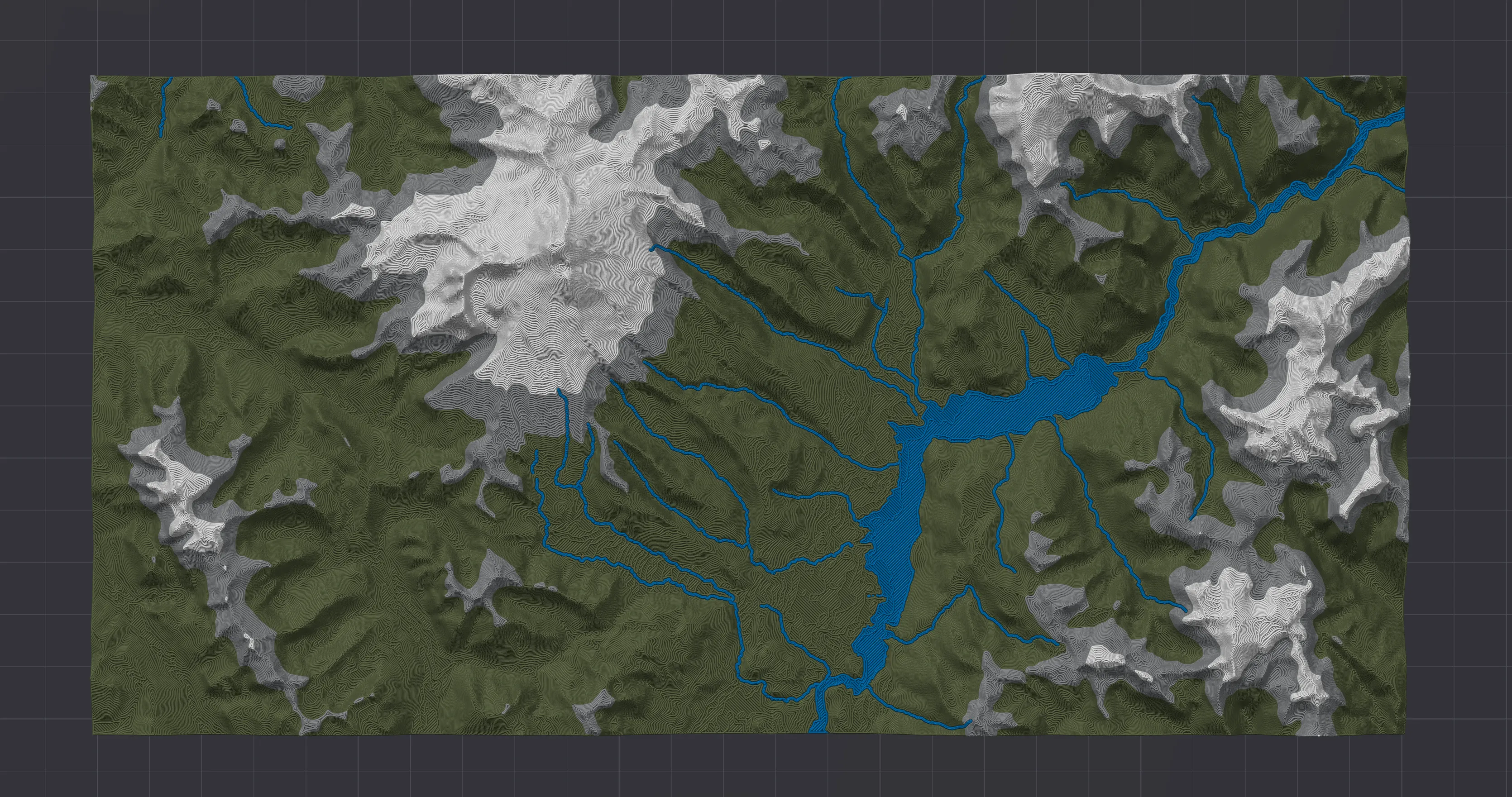
We've rebuilt the model viewer from the ground up to use GPU shaders for elevation coloring. This replaces the old CPU-bottlenecked mesh slicing, resulting in much faster model generation and much smoother navigation, especially at high resolutions.
The export system has been decoupled from the viewer and migrated to a high-performance Manifold-based worker. This ensures that even the most complex models with combined layers and painted features are perfectly 100% watertight and manifold for slicing.
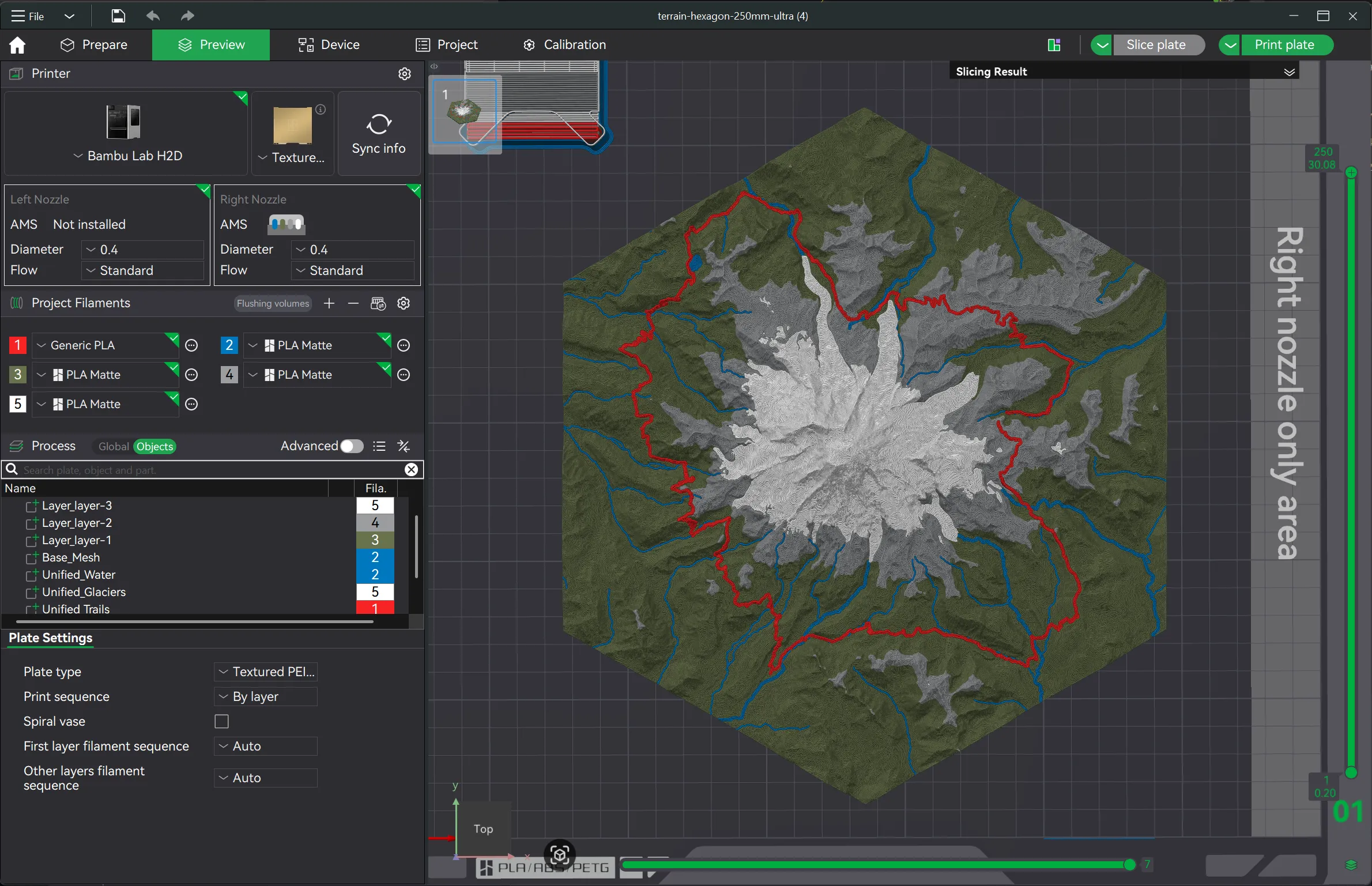
Cleaned up the workspace with a new sidebar-focused layout and a consolidated top bar, providing more breathing room for the map and 3D viewer.
v1.05 - Experience Update
Jan 21, 2026Focused on improving user experience with a new compass, improved search, and various UI refinements.
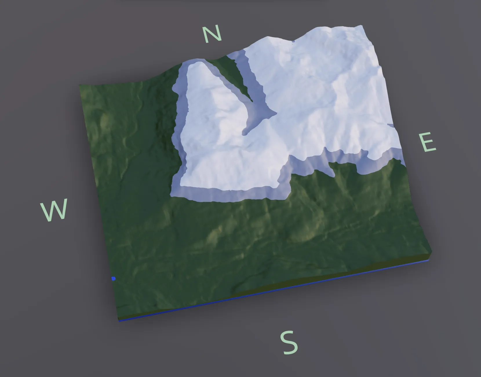
Added a dynamic compass to the model viewer. The compass labels (N, S, E, W) float around the mesh boundaries, providing clear orientation reference while you navigate your model.
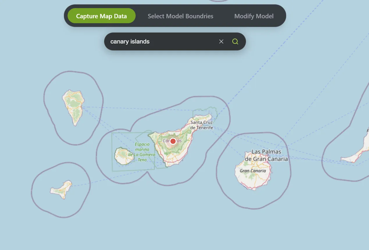
Introduced a new search bar for the map interface. You can now easily search for locations, and a pin will highlight your result. The interface also includes improved controls for clearing search results.
A collection of UI and UX improvements based on user feedback:
- Brightened the Model Viewer for better visibility.
- Projects now persist when switching between tabs, reducing reload times.
- Default smoothing set to 0 to preserve terrain details.
- Highlighted the currently selected map for better clarity.
- Improved visual separation in the UI panels.
- Fixed search pin visibility issues on the map.
v1.04 - Manifold Export
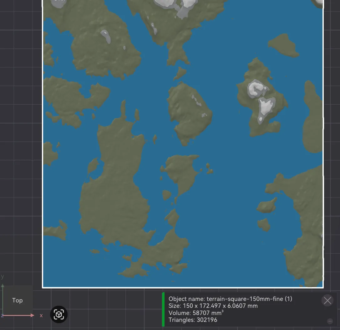
Jan 20, 2026Fully reworked mesh export pipeline for 100% watertight, manifold meshes.
Fully reworked the mesh export pipeline. The model viewer and mesh export pipeline are now separate entities. The export process now utilizes new libraries to ensure reliable cuts and guaranteed watertight meshes. You should see zero non-manifold errors in slicers like Bambu Studio.
v1.03 - Download Manager
Jan 16, 2026Added a background download manager for more reliable large file exports.
Added a dedicated download manager worker to the application. This allows large file downloads and processing to happen in the background without freezing the UI or timing out in Chrome. You can now continue to use the app while your exports are being prepared.
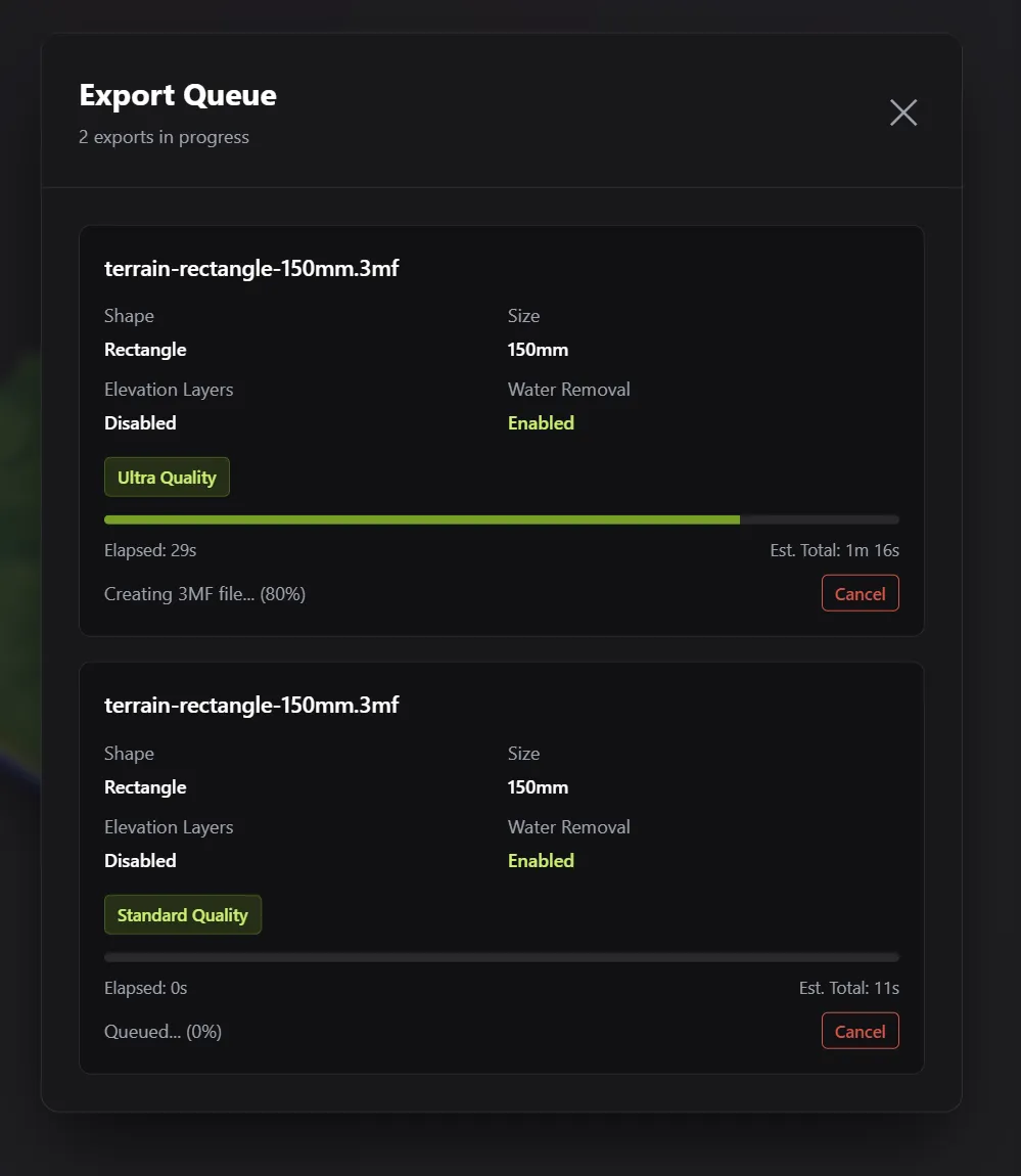
Added new UI elements to make it easier to track export progress and navigate to your downloads.
v1.02 - Elevation Colors
Jan 14, 2026Introducing elevation layers for multi-color exports, plus major mesh and wall generation improvements.
I've added a donation-based payment scheme to support the site's costs without forcing a high flat rate.
You can now pay whatever you want to get 3 months of access to all Pro features. This allows everyone to explore and create at their own pace.
If you make an additional donation before your time has elapsed, it will reset your 3-month timer. Thank you so much for your donations; I hope this tool is helping you create beautiful projects.
Added elevation-based layering, enabling multicolor printing based on elevation layers. You can now split the terrain into distinct height-based layers, your slicer will import these as multiple meshes allowing you to assign colors to the mesh objects.
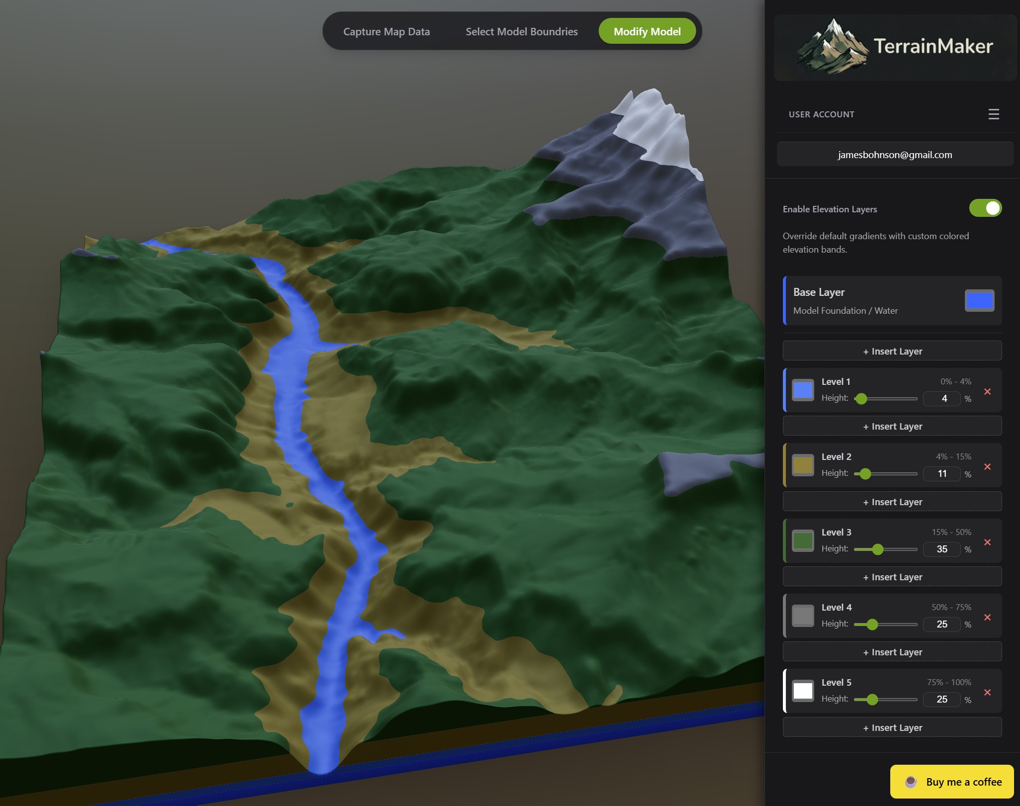
Modified the mesh export pipeline to fully enable .3mf file generation. This ensures that the new elevation layers are correctly preserved and interpreted by multicolor slicers.
Overhauled the mesh generation and wall building to eliminate micro-divots. The result is cleaner, more uniform walls on the outside edges.
Modified coastline generation logic to be more robust. While edges may appear slightly more jagged up close compared to previous versions, this ensures better stability and does not impact the quality of the final printed model.
Updated visuals for the model viewer and refined the controls to make navigation smoother and more intuitive.
Added lighting presets in the 3d viewer - cycle through different lighting conditions to find your preferred view.
v1.01 - Coastline Overhaul
Jan 10, 2026A major update to how coastlines are generated, plus new UI controls.
This update gives coastlines a much smoother feel with less jagged lines. This is great for most scenarios, but obviously there are some scenarios where you want a nice jagged looking coastline. I will leave this coastline method for now until I can circle back to a more... interesting... method.
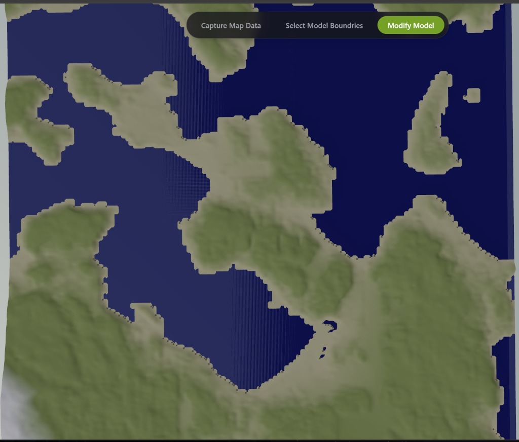
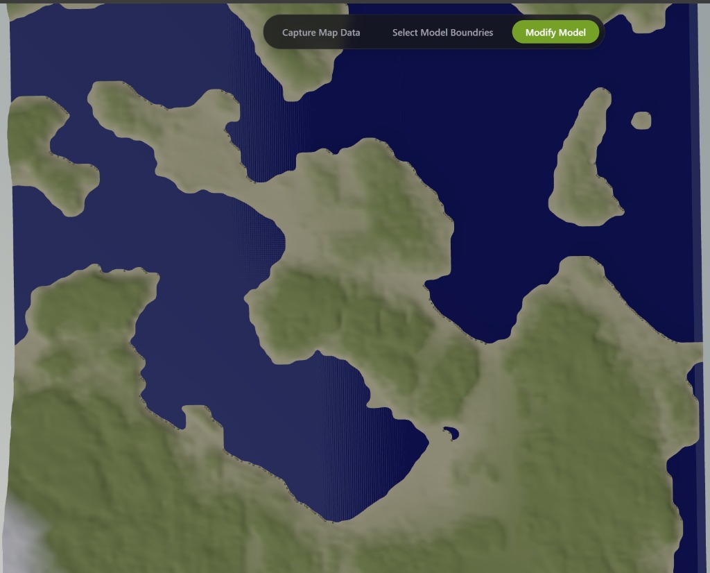
Wire artifacts that were present on most coastal map generations have been eliminated.
v1.0 - Initial Release
Jan 3, 2026Released v1.0! Free for all users.
Email pass authentication is managed by Supabase!
Data collection is minimal - just your saved maps. That's literally it.
(Almost) Real time model viewer and editor!
Great results using techniques to get high-quality models without the immense size typical of terrain data models.